Earthquakes occur when accumulated stress overcomes friction on a fault and rocks slip suddenly, releasing energy as seismic waves.
Key takeaways
- Most earthquakes result from sudden slip on faults where tectonic stress has accumulated.
- Seismic waves carry released energy through Earth and produce the shaking measured by instruments.
- Scientists can estimate earthquake probabilities and hazards, but they cannot reliably predict the exact time and place of a major earthquake.
In this article
- Stress, faults and sudden slip
- Why earthquakes cluster near plate boundaries
- How earthquake energy becomes ground shaking
- Magnitude, intensity and local shaking
- Aftershocks, foreshocks and earthquake sequences
- Fault type, depth and secondary hazards
- Forecasting, early warning and preparedness
- How earthquakes are located and characterized
- Hazard is not the same as risk
Stress, faults and sudden slip
Earth’s outer shell is divided into tectonic plates that move slowly relative to one another. Plate motion is usually measured in millimeters or centimeters per year, but the rocks along a fault do not always slide smoothly. Rough surfaces can lock together while the surrounding crust continues to deform.
As stress builds, elastic energy accumulates in the rocks. When the stress exceeds the frictional resistance of the fault, part of the fault can slip abruptly. That sudden movement is an earthquake. The point inside Earth where rupture begins is the hypocenter, while the point on the surface directly above it is the epicenter.
Why earthquakes cluster near plate boundaries
Many of the world’s earthquakes occur near boundaries where plates converge, diverge or slide past each other. Subduction zones can produce some of the largest earthquakes because very large fault surfaces may become locked. Transform boundaries generate strike-slip earthquakes, while rift zones and spreading centers are associated with extensional faulting.
Earthquakes can also occur within tectonic plates. Old faults may be reactivated by present-day stresses, and human activities such as fluid injection can alter stresses or pore pressure in some settings. Plate boundaries explain the broad global pattern, but local geology determines where individual faults are capable of slipping.
How earthquake energy becomes ground shaking

When a fault ruptures, energy propagates outward as seismic waves. P waves compress and expand material in the direction of travel and move fastest. S waves shear material from side to side and travel more slowly. Surface waves move along Earth’s exterior and can produce strong, prolonged motion.
The shaking felt at a particular site depends on more than earthquake magnitude. Distance from the rupture, rupture direction, depth and local ground conditions all matter. Soft sediments can amplify certain kinds of motion, which is why neighborhoods at similar distances from an earthquake can experience different levels of shaking.
Magnitude, intensity and local shaking
Magnitude describes the size of an earthquake at its source. Modern seismology commonly uses moment magnitude for significant events because the calculation relates to fault area, average slip and rock rigidity. Intensity describes the severity of shaking and its effects at a particular location, so one earthquake has one magnitude but many intensity values across the affected region.[1]
Local shaking depends on distance from the rupture, earthquake depth, the direction in which rupture propagates and the materials beneath a site. Soft sediments can amplify some frequencies of motion, sedimentary basins can trap seismic energy, and saturated loose soils may lose strength during strong shaking in a process called liquefaction. A moderate earthquake close to a vulnerable city can therefore be more damaging locally than a larger but distant event.[2]
Aftershocks, foreshocks and earthquake sequences
A mainshock changes stresses in the surrounding crust. Smaller earthquakes called aftershocks commonly follow as faults adjust. Aftershock activity generally decreases with time, but significant aftershocks can occur days, months or longer after a large event.
A smaller earthquake can only be called a foreshock in hindsight, after a larger earthquake follows in the same area. The existence of foreshocks does not currently provide a reliable way to identify in advance which small earthquakes will be followed by larger ones.
Fault type, depth and secondary hazards
Normal faults accommodate extension, reverse and thrust faults accommodate compression, and strike-slip faults mainly accommodate horizontal shear. Real fault systems can combine these motions. Most damaging earthquakes are shallow, but subduction zones can also produce earthquakes hundreds of kilometers deep as a descending plate deforms. Fault geometry and depth influence which areas experience the strongest motion.[2]
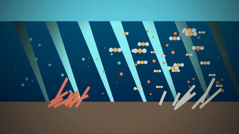
Ground shaking is only one part of earthquake risk. Surface rupture can break roads and pipelines; steep slopes may fail as landslides or rockfalls; liquefaction can damage foundations and buried infrastructure. Undersea earthquakes can generate tsunamis when sudden seafloor displacement moves a large volume of water. Whether these secondary hazards dominate the disaster depends on topography, coastal geometry, sediment conditions and the vulnerability of exposed communities.[5]
Forecasting, early warning and preparedness
Scientists can map active faults, estimate long-term earthquake probabilities and model the level of shaking that different regions may experience. Those products support building codes, infrastructure design and emergency planning. They are not deterministic predictions of the exact time, place and magnitude of the next major earthquake. The U.S. Geological Survey states that reliable short-term prediction of that kind is not currently possible.[4]
Earthquake early warning solves a different problem. It detects a rupture after it has begun and sends electronic alerts faster than the strongest seismic waves can travel. Depending on distance from the source, the warning may range from almost none to tens of seconds, but even brief notice can allow automated systems to slow trains, pause industrial processes or prompt people to take protective action.[3]
Because exact prediction is unavailable, risk reduction focuses on resilient construction, securing nonstructural hazards, protecting lifelines, practicing emergency procedures and using hazard maps to guide land-use and engineering decisions. Preparedness changes the consequences of an earthquake even though it cannot change when the fault slips.[2]
How earthquakes are located and characterized
Seismologists determine an earthquake’s location by comparing the arrival times of different seismic waves at multiple stations. P waves usually arrive first, followed by slower S waves. The time difference at each station constrains the distance to the source, and a network of stations allows the hypocenter and origin time to be estimated. Modern networks also use waveform shape, amplitude and frequency content to characterize the rupture and rapidly calculate preliminary magnitude values.[2]
Instrumental measurements are revised as more data arrive. Early automatic solutions are valuable for alerts, but final catalogs can incorporate additional stations and improved models of how seismic waves travel through the crust. This is why the first magnitude reported after a major earthquake may change without implying that the earthquake itself became larger or smaller.
Hazard is not the same as risk
Earthquake hazard describes the expected physical phenomena—such as strong shaking, surface rupture or liquefaction—while risk also depends on what is exposed and how vulnerable it is. Two cities with similar shaking hazard can face very different consequences because of building quality, population density, infrastructure and preparedness. Engineering therefore uses hazard maps together with site investigations and building standards rather than treating magnitude alone as a forecast of damage.[2]